A map of Cambridge’s greenbelt, mapped from one of the little rural enclaves with a view of said belt from my window.
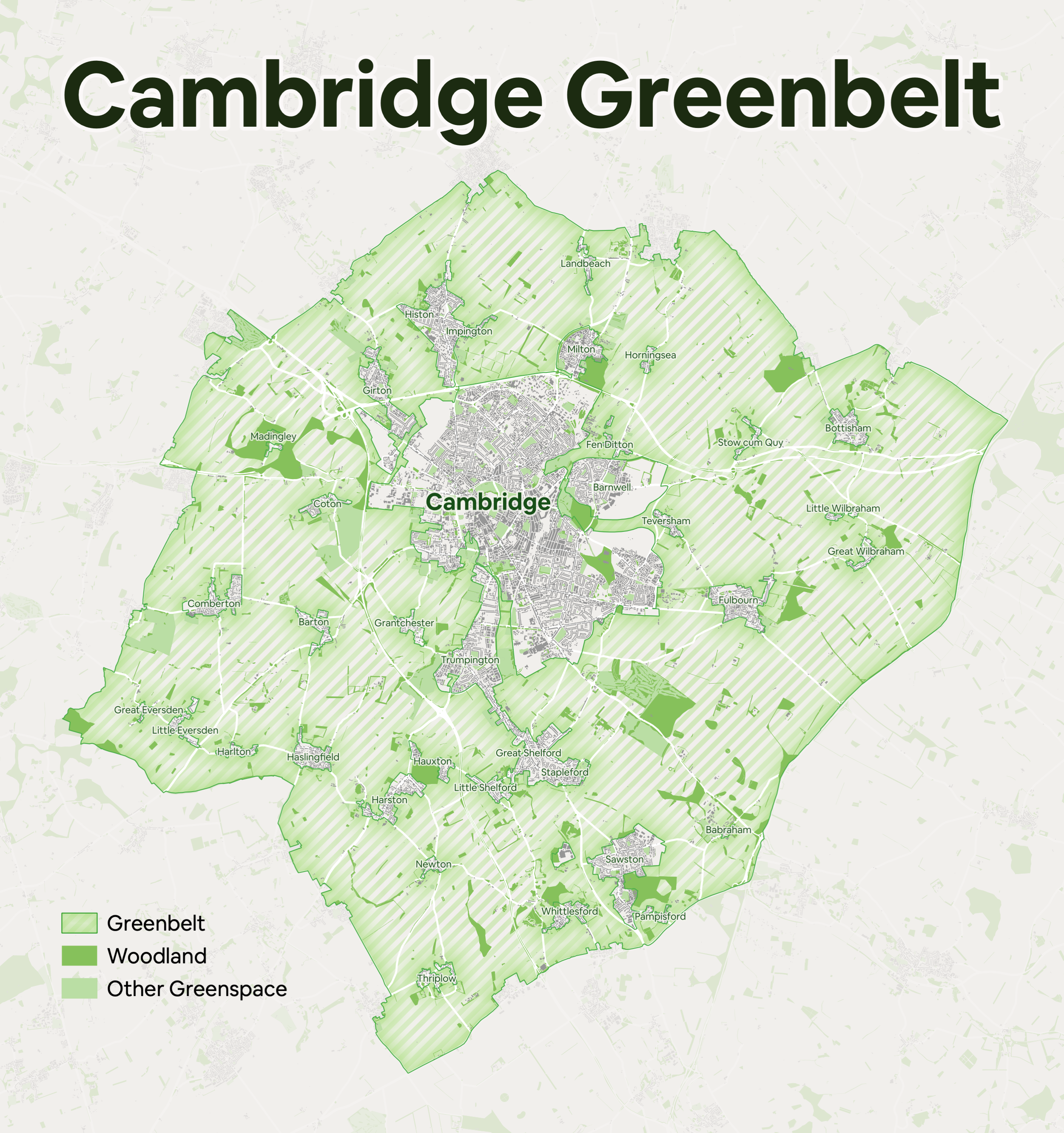
Data: greenbelt via the (now former) Department for Communities and Local Government INSPIRE OGC WFS Service, everything else from OS Open Zoomstack. Tools: QGIS, making use of the ability to combine multiple symbologies (namely shapeburst, striped fill, and outline for the greenbelt itself).