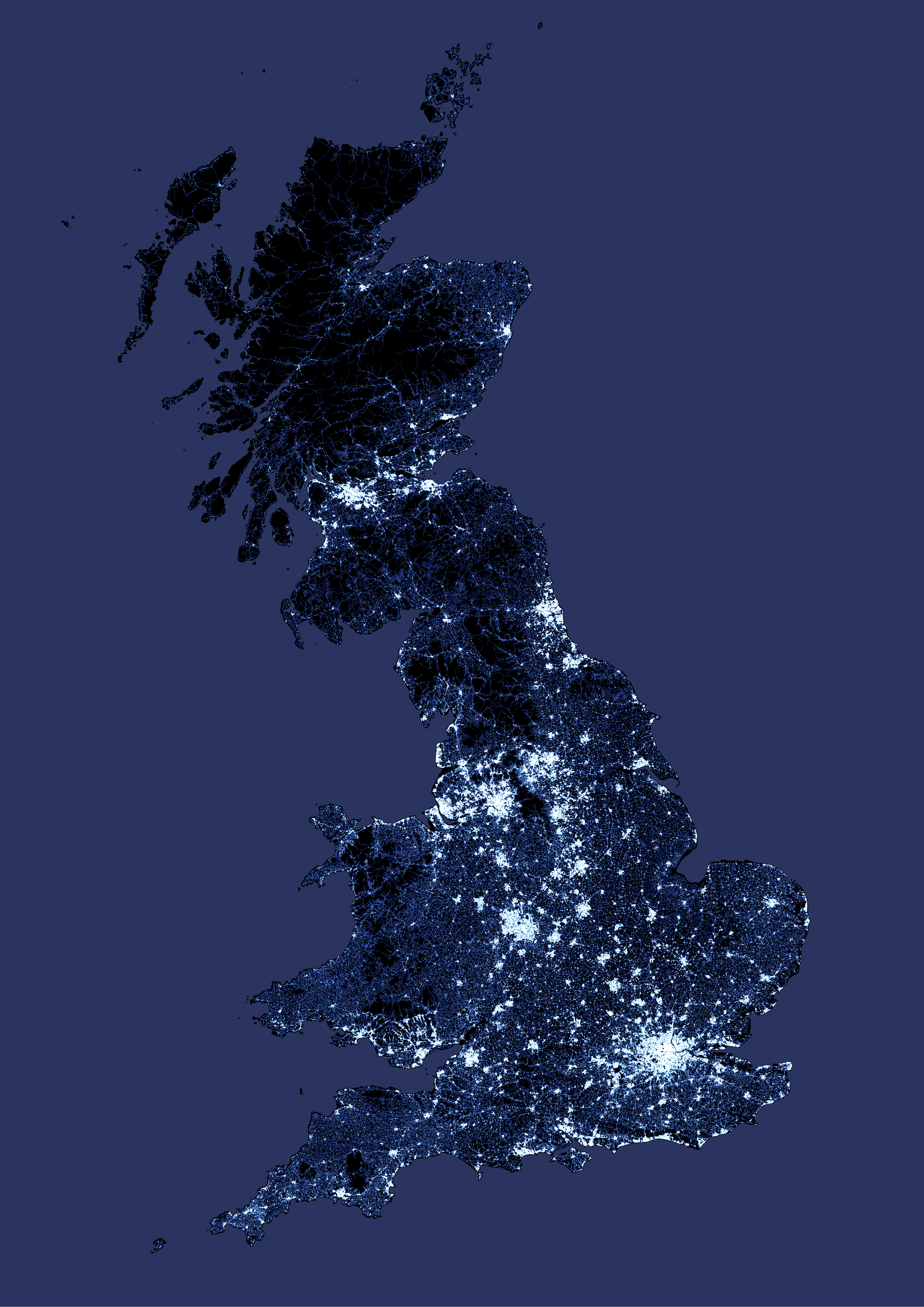
All of the roads in Great Britain, taken from Ordnance Survey’s Open Zoomstack data and mapped in QGIS using colour blending to make areas with more roads whiter.
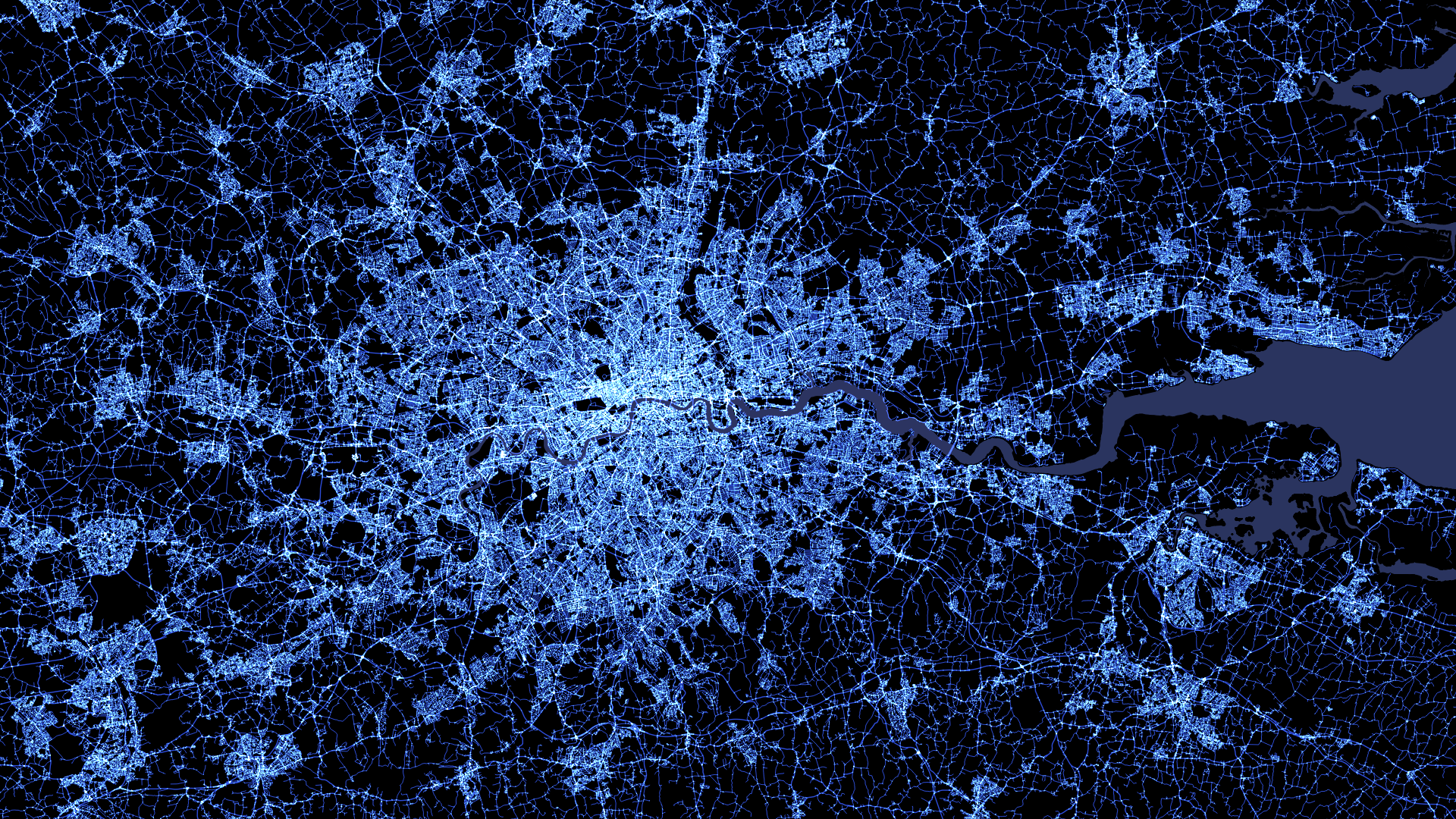
A closer view of of dense London:
And a nice chunk of sparser Scotland by means of contrast:
