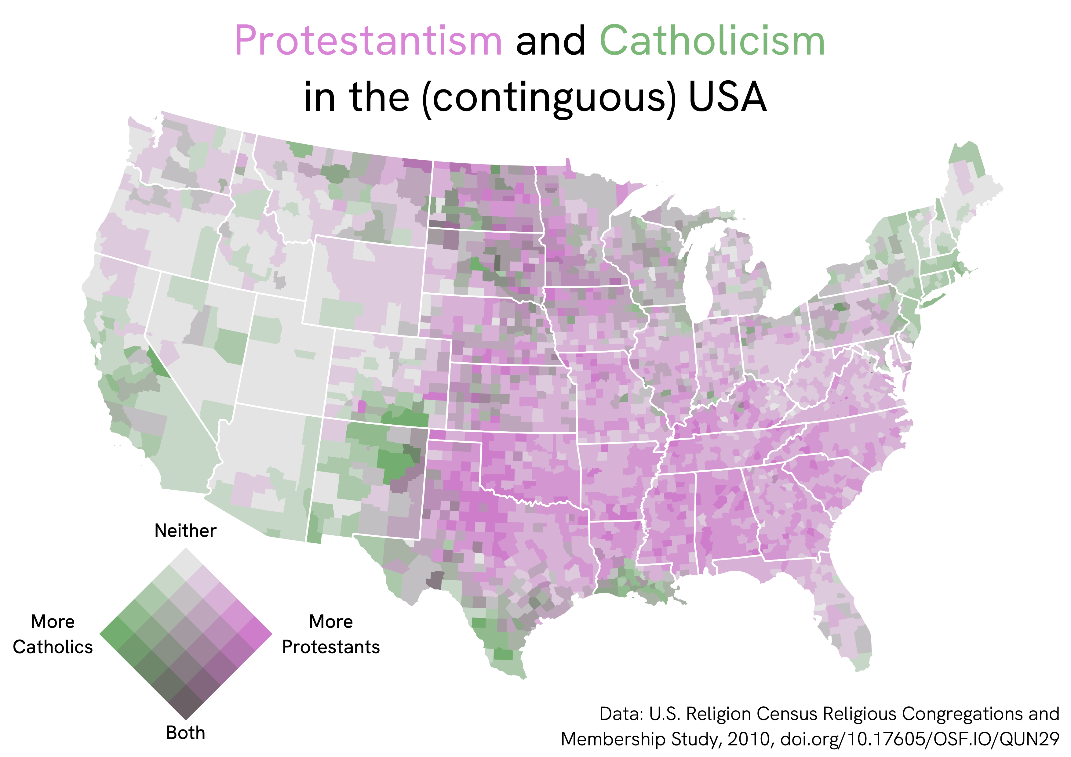
Protestantism and Catholicism in the (contiguous) USA (sorry Alaska + Hawaii), mapped in QGIS as a bivariate choropleth map.

The nice legend was made with the bivariate legend plugin for QGIS.
Data at county level from the 2010 U.S. Religion Census Religious Congregations and Membership Study.