A first attempt at making a relative elevation model in QGIS, following excellent tutorials by Daniel Coe.
For those not in the know, a relative elevation model (REM) is basically a standard DEM, but normalised to the elevation of a river channel so the value of a given pixel gives the height of that point above the height of the nearest part of the river channel. Or so the theory goes – the creation of an REM in practice is as much of an art as a science and you can get quite different results depending on how you go about creating the REM.
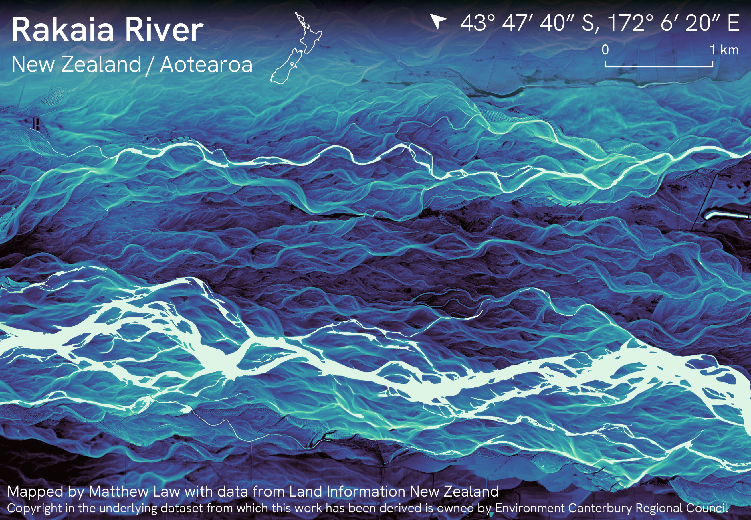
Made with 1m LiDAR-derived elevation data from Land Information New Zealand.
It’s interesting seeing the extent to which this kind of elevation data can reveal hydrological patterns that there’s no way of seeing when looking at aerial imagery:

Original tweet thread here:
My first attempt at making a relative elevation model in QGIS, following excellent tutorials by @geo_coe
📍 Rakaia River 🇳🇿 https://t.co/yWM9IqeROd pic.twitter.com/IiBtZ0MpmO— Matthew Law (@Iawmatthew) February 3, 2022