Whiling away the finite hours of my life reading Wikipedia, I came across a map purporting to show different regions for the UK’s numbered roads. Immediately I questioned its accuracy: I live firmly within the ‘1’ zone, and while it is true that most of my local numbered roads begin with 1 I’m also a frequent driver on the local A428, A505, and A603, so surely the regions mapped can’t be accurate. Naturally, the only course of action was to map out this hypothesis myself, using data from Ordnance Survey’s Open Zoomstack. The answer is that the Wikipedia map is mostly accurate, although there is definitely some overlap:
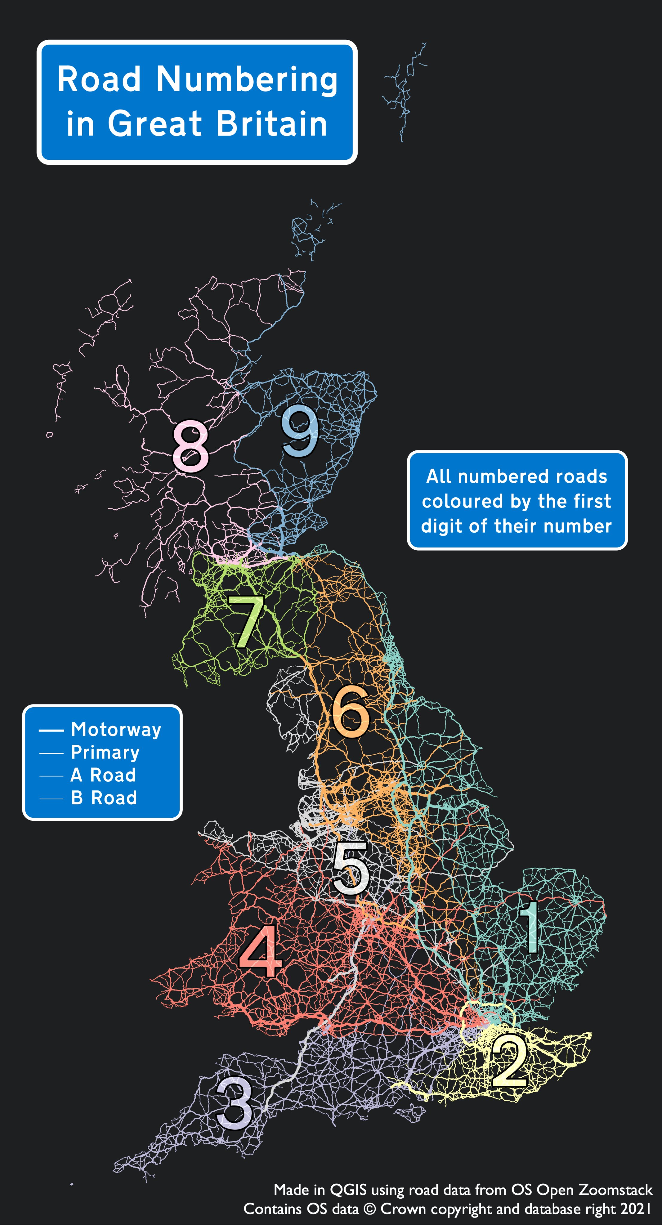
I used a symbology expression in QGIS to colour the roads by number:

(I believe this is what the kids call a Hit Tweet)
#30DayMapChallenge Day 2: Lines
Great British roads, coloured by their numbers pic.twitter.com/aT5Vp0W89a— Matthew Law (@Iawmatthew) November 2, 2021