Full interactive map:
The map was made in QGIS with the ‘Generate XYZ Tiles’ tool and data from a few different sources:
Forests, woods, and orchards from OpenStreetMap
Street trees from the London Datastore
Building outlines, roads, and place names from Ordnance Survey’s Open Zoomstack
Greenspaces from Ordnance Survey’s Open Greenspace
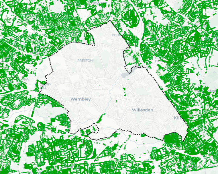
The tree data also highlights the effect of the infamous tree ban in the London borough of Brent (shown below with a dotted outline):